
 |
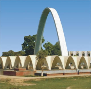
| Sahiwal |
 |
| Harrapa |
built approximately 2600 BCE. The area was part of South Asian empires and in crossroads of migrations and invasions from Central Asia. The pastoral tribes of this barren expanse did not appear to have paid more than a nominal allegiance to the Muslim rulers, the population for the most part remained in a chronic state of rebellion. Sahiwal is located close to Pakpattan, a famous medieval town and Muslim Sufi pilgrimage site. Pakpattan owes its sanctity and modern name, 'the holy ferry', to the shrine of the great Muslim Sufi Fariduddin
Ganjshakar Shaikh-ul-Islam, Farid-ul-Hakkwa-ud-Din, Shakar Ganj (1173–1265) which was visited by old great traveler and historian Ibn Batuta in 1334. The native population converted to Islam by Sufi missionaries. After the decline of the Mughal Empire, the Sikh took control of Sahiwal. The inhabitants were treated benevolently during Sikh rule. The district came under direct British rule in 1849, when the district was officially formed with its headquarters at Pakpattan. The district was expanded to include the trans-Ravi portion in 1852, and the district headquarters were moved to Gogera. In 1865, when the railway was opened, a village on the railway side, was named
(Sahiwal cow, sahiwal history, sahiwal weather, sahiwal coal powerr plant, postal code, sahiwal fun, sahiwal board.)
"Montgomery" and became the capital of the district.[7]
During the Indian Rebellion of 1857, there was a general uprising of the Muslim population of Sahiwal, and the district formed the scene of the only uprising which took place north of Sutlej. Before the end of May 1857, emissaries from Delhi crossed the river from Sirsa and Hisar, where open rebellion was already ripe, and met with a ready reception from the Kharals and various other Muslim tribes. The district authorities, however, kept down the threatened uprising till August 26, 1857 when the prisoners in jail made a desperate attempt to break loose. At the same time Ahmad Khan, a famous Kharal leader, who had been detained at Gogera, broke his arrest, and though apprehended, was released on security, together with several other suspected chieftains. On September 16, they fled to their homes, and the whole country rose in open rebellion. Kot Kamalia was sacked; and Major Chamberlain, moving up with a small force from Multan, was besieged for some days at Chichawatni on the Ravi. The situation at the civil station remained critical till Colonel Paton arrived with substantial reinforcements from Lahore. An attack which took place immediately after their arrival was repulsed. Several minor actions followed in the open field, until finally the rebels, driven from the plain into the jungles of the interior, were utterly defeated and dispersed. The British troops then inflicted severe punishment on the insurgent clans, destroying their villages, and seizing large numbers of herds.[8]

ساہیوال ضلع
| ساہیوال ضلع | |
|---|---|
| ضلع | |
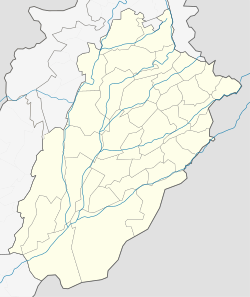
 Location of Sahiwal in Punjab. | |
| ملک | پاکستان |
| پاکستان کی انتظامی تقسیم | پنجاب، پاکستان |
| دار الحکومت | ساہیوال |
| آبادی (1998) | |
| • کل | 1,843,194 |
| منطقۂ وقت | پاکستان کا معیاری وقت (UTC+5) |
| ویب سائٹ | www.sahiwal.gov.pk |
ساہیوال ضلع کی مجموعی آبادی 1,843,194 افراد پر مشتمل ہے۔
ساہیوال پنجاب کا ایک خوبصورت اور سرسبز و شاداب شہر ہے۔ اس کا پرانا نام منٹگمری تھا۔ یہاں ساہی قوم کی اکثریت کی وجہ سے نام ساہیوال ہوا ساہیوال کی نیلی بار کی گائے دنیا بھر میں مشہور ہے ساہیوال ایک پر امن شہر ہے جوگی چوک شہر کا انتہائی مصروف حصہ ہے انگریزوں کے زمانے سے پہلے بھی اس کا نام ساہیوال ہی تھا۔ انگریزوں نے تبدیل کرکے منٹگمری رکھا تھا۔ جسے بعد میں پھر ساہیوال کر دیا گیا تھا۔ کیونکہ انگریزوں کی یہاں کی ایک قوم ’’ساہی‘‘ سے اچھی نہ بنتی تھی کینال کالونی کنان پارک اور اسٹیڈیم کے آس پاس کا علاقہ دیکھنے سے تعلق رکھتا ہے اور ابهى حال ہی میں ايک نيا فريدیہ پارک كو خوبصورت بنايا اور تفريح كا اور جهولوں كا اضافہ كيا جو كہ ساہيوال كو اور خوبصورت بناتا ہے ساہيوال كا لڑكوں كا كالج بهى بہت مشہور
ہے۔.
ہے۔.
ساہیوال ڈویژن
| ساہیوال ڈویژن Sahiwal Division | |
|---|---|
| ڈویژن | |
 صوبہ پنجاب میں ساہیوال ڈویژن کی جگہ، صوبہ پنجاب پاکستان میں(چھوٹی تصویر). | |
| ملک | پاکستان |
| صوبہ | پنجاب |
| صدر مقام | ساہیوال |
| قیام | 2008[1] |
| اضلاع | 3 |
| حکومت | |
| • قسم | ضلع |
| • ڈویژنل کمشنر | نبیل احمد اعوان |
| • ڈسٹرکٹ کوآرڈینیشن آفیسر | ذوالفقار گھمن |
| رقبہ | |
| • کل | 10,302 کلو میٹر2(3,978 مربع میل) |
| آبادی (1998) | |
| • کل | 6,271,247 |
| ساہیوال ڈویژن میں موجود تمام اضلاع کی مجموعی آبادی | |
| منطقۂ وقت | PST (UTC+5) |
| پوسٹل کوڈ(ڈاک رمز) | 57000 |
| ڈائلنگ کوڈ | 040[2] |
| ویب سائٹ | www |
ساہیوال ڈویژن صوبہ پنجاب کے تین اضلاع ضلع ساہیوال، ضلع پاکپتن اور ضلع اوکاڑہ پر مشتمل پاکستان کا ایک ڈویژن ہے۔ 2008ء کے عام انتخابات کے بعد پنجاب نے اس کے آٹھ ڈویژنوں کو بحال کر دیا۔[3]
ہڑپہ پاکستان کا ایک قدیم شہر ہے جس کے
کھنڈر پنجاب میں ساہیوال سے 35 کلومیٹر مغرب کی طرف چیچہ وطنی شہر سے 15 کلو میٹر پہلے کھدائی کے دوران ملے۔ حضرت عیسی علیہ السلام کی پیدائش سے تقریباً 1200 سال پہلے لکھی جانے والی ہندووں کی کتاب رگ وید سے اس شہر کی تاریخ کا اندازہ لگایا گیا ہے۔
کھنڈر پنجاب میں ساہیوال سے 35 کلومیٹر مغرب کی طرف چیچہ وطنی شہر سے 15 کلو میٹر پہلے کھدائی کے دوران ملے۔ حضرت عیسی علیہ السلام کی پیدائش سے تقریباً 1200 سال پہلے لکھی جانے والی ہندووں کی کتاب رگ وید سے اس شہر کی تاریخ کا اندازہ لگایا گیا ہے۔
رگ وید میں ایک شہر کا نام آیا ہے ’ ہری یوپیہ ‘ سنسکرت میں اس کا مطلب ہے ’ قربانی کے سنہری ستوں والا شہر ‘ ماہرین کا اب اتفاق ہے۔ جن میں ویلز اور ڈی ڈہ کوسامبی شامل ہیں کہ ہری یوپیہ ہڑپہ ہی کا سنسکرت میں نام ہے۔ اگرچہ اس کا اصل نام کچھ اور ہوگا، شاید ہری یوپویا ہو یا کچھ اور ہو اور جس کو رگ وید کے مطابق اسی ہری یوپیہ کے قریب آریاؤں کی مقامی باشندوں سے جنگ ہوئی تھی۔ رگ وید میں آیا ہے اندرا نے ورشکھو ( یا ورچکھو ) کی باقیات کو ایسے ملیامیٹ کر دیا کہ جیسے مٹی کا برتن۔ اس نے ورچی وات ( یا ورشی ونت یا ورکی وات ) لوگوں کے ایک سو تیس مسلح جانبازوں کی پہلی صف کو کچل دیا۔ جس پر باقی بھاگ کھڑے ہوئے ۔
دریافت[ترمیم]
1921ء کا واقع ہے کہ رائے بہادر دیا رام سہنی نے ہڑپا کے مقام پر نے قدیم تہذیب کے چند آثار پائے۔ اس کی اطلاع ہندوستانی محکمہ آثار قدیمہ کو ملی۔ محکمہ کے ڈائریکٹر جنرل سر جان مارشل نے دلچسپی کا اظہار کرتے ہوئے ہڑپہ کی کھدائی کی طوجہ دی۔ چنانچہ رائے بہادر دیا رام سہنی، ڈائریکٹر ارنسٹ میکے اور محکمہ اثریات کے دیگر احکام کے تحت کھدائی کا کام شروع ہوا۔ 1931ء میں فنڈ کی کمی کی وجہ سے کام روک دیا گیا۔ بعد میں بھی کھدائی کا کام بھر پور طریقہ سے نہیں ہو سکا۔ قدیم ہڑپہ کے مقام سے موجوددہدریائے راوی تقریباً چھ میل دور ہے۔ لیکن جب یہ شہر آباد تھا تو راوی اس کے قریب بہتا تھا۔ اس لیے ہڑپہ کے قلعے کے قدیم دور میں اس کے ساتھ کچی اینٹوں اور مٹی سے ایک بڑا حفاظتی بند بنایا گیا ہے۔ جب کبھی راوی میں سیلاب آیا کرتا ہوگا تو یہ بند قلعے کی حفاظت کرتا تھا۔ ہڑپہ اور موئن جو دڑو دونوں شہروں کا نقشہ اور ترتیب آپس میں انتہائی مشابہت رکھتے ہیں۔ اگرچہ ہڑپہ سے ان گنت اینٹیں لوگوں نے چوری کرکے نئی تعمیرات میں استعمال کیں اور لاہور ملتان ریلوے لائین بچھانے کے سلسلے میں یہاں سے ملبہ اٹھا کر استعمال کیا گیا۔ جس وجہ سے ہڑپہ کی مکمل شکل و صورت ماہرین آثار کے سامنے نہیں آسکی۔ پھر بھی جو کچھ بچا ہے اس سے ثابت ہوتا ہے کہ ہڑپہ کا عمومی نقشہ موہونجودڑو جیسا تھا۔ ہڑپہ کی سب سے نیچی تہ موہنجودڑو کی پہلی تہ سے زیادہ پرانی معلوم ہوتی ہے اور وہاں کی آخری۔ یعنی سب سے بعد کی تہوں میں ایسے آثار ملے ہیں جوموئن جو دڑوکے آخری زمانے کے بعد کے ہیں ۔
قلعہ[ترمیم]
قلعہ جنوب مغرب میں ہے اور نچلا شہر مشرق اور جنوب مشرق میں ہے۔ ان دونوں کے درمیان میں منظم شہر کی باقیات ہیں۔ قلعے کے جنوب میں ایک پہاڑی ہے اور قبرستان ہے۔ جسے ’ مدفن H ‘ کہتے ہیں۔ شمالاً جنوباً 460 گز اور اس کی موجودہ چوٹی کی زمین شمال سے جنوب کی طرف ڈھلان رکھتی ہے اور اس کی سب سے اونچی جگہ ایک جدید قبرستان ہے۔ جس کی وجہ سے کھدائی نہیں کی جاسکی۔ یہ سب اونچی جگہ ارد گرد کی سطح زمین سے 45 فٹ تا 50 فٹ اونچی ہے۔ قلعے کے اندر کی عمارتیں اس وقت زمین سے بیس تا پچیس اونچے چبوترے پر بنائی گئی تھیں۔ چبوترا مٹی اور کچی اینٹوں سے بنایا گیا تھا اور اس کے ارد گرد نہایت موٹے حفاظتی پشتے تھ۔ اس پشتے میں ایک مختصر سی جگہ کھودی گئی ہے۔ اس کے نیچے برتنوں کے کچھ ٹکڑے ملے ہیں۔ جس کا مطلب ہے یہاں قریب انسانی آبادی رہی ہوگی۔ کچھ برتن رانا غندئی کے سطح سوم کے برتنوں جیسے ہیں۔ یہ پہلی آبادی ہے جو گاؤں کے لوگوں کی ہے۔ ان برتنوں پر سرخ رنگ کیا ہوا تھا۔ پھر اس پر سیاہ رنگ نقاشی کی گئی ہے۔ اس کے بعد دوسرے دور میں قلعے کی ایک عظیم فیصل بنتی ہے اور اس کے ساتھ ایک حفاظتی پشتہ بنایا جاتا ہے۔ جو اینٹ روڑوں اور مٹی سے بھرا گیا ہے۔ یہ پشتہ بنیادوں کے قریب 35 فٹ چوڑا ہے اور اوپر چڑھتے ہوئے پتلا ہوجاتا ہے۔ اصل فصیل اندر اور باہر سے پختہ اینٹوں سے بنی ہے اور بیچ میں کچی اینٹوں سے بھرائی کی ہے۔ اس دیوار کی کل موٹائی چایس فٹ ہے اور اونچائی 35 فٹ۔ فصیل کے باہر جو پختہ اینٹوں کی دیوار ہے وہ چار فٹ موٹی ہے۔ قلعے کی فصیل میں تھوڑے تھوڑے فاصلے پر حفاظتی برج بنے ہوئے ہیں۔ جو فصیل سے اونچے ابھرے ہوئے ہیں۔ قلعے کا اصل پھاٹک شمالی جانب تھا۔ ایک چور دروازہ مغربی جانب تھا۔ جس کے آگے ایک حفاظتی برج تھا۔ اس چور دروازے سے اندر داخل ہوں تو اندر کئی دروازے ہیں۔ جس کے اندر دمدمے اور چبوترے ہیں اور ان کی بغل میں محافظوں کے کمرے ہیں۔ چور دروازے کی بھول بھلیوں کے جنوبی سرے پر ایک خفیہ راستہ زینے کے ذریعے قلعے کے اندر داخل ہوتا تھا۔ ہڑپہ میں زینے کا استعمال عام تھا۔ قلعے کی تعمیر سے ظاہر ہوتا ہے کہ یہ پہلی بار اتنی عمدگی سے نہیں تعمیر کیا گیا۔ بلکہ اس کی تعمیر کے بھی کم از کم تین مرحلے ہیں۔ پہلی بار قلعہ پکی اینٹوں کے ٹکڑوں سے بنایا گیا تھا اور اس پر کسی حملے کے اثرات کا پتہ نہیں چلتا ہے۔ بلکہ صرف موسمی اثرات دیکھنے میں آتے ہیں۔ دوسری تعمیر پختہ سالم اینٹوں سے کی گئی۔ اس مرتبہ فن تعمیر پہلے سے بدرجہ بہتر ہے۔ تیسری تعمیر میں فصیل کے ارد گرد بھاری بھرکم پشتے لگائے گئے ہیں اور قلعہ واقعی زبردست قلعہ بن گیا۔ اس مطلب ہے ایک تو یہ ہے کہ حکمرانوں کی خوشحالی میں زبردست اضافہ ہوا ہے۔ دوسرے یہ بھی ہے کہ عوام کے بالمقابل اور دیگر حملہ آوروں کے خلاف حفاظت کی ضرورت کا بڑھ جانا ہے۔
غلام گھر[ترمیم]
قلعے کے شمال کی جانب ایک بیس فٹ اونچی اور 300 گز مربع وسیع ڈھیری کی کھدائی کی گئی ہے۔ اس کے نیچے سے اہم عمارتیں برآمد ہوئیں۔ قلعہ کے قریب فوجی بیرکوں کے انداز کی عمارتوں کی دو قطاریں چلی گئی ہیں۔ ایک قطار میں سات اور دوسری میں آٹھ گھر ہیں۔ ہر گھر کے آگے پیچھے دائیں بائیں گلیاں ہیں۔ کہیں بھی دو گھر کی دیواریں ساتھ نہیں ہیں۔ ہر گھر کا سائز 52 * 24 فٹ ہے۔ ہر گھر ایک کمرے پر مشتمل تھا۔ ہر گلی تین سے چار فٹ چوڑی تھی۔ ہر گھر میں داخلے کا رستہ ترچھا اور خفیہ تھا۔ یہ آبادی انتہائی منظم طریقہ سے بنی ہے اور تنطیم میں باقائدہ شہر ہے جو انتہائی منظم ہے۔ حد درجہ منفرد اور نمایاں ہے۔ یقینا یہ حکومت نے سرکاری منصوبہ بندی کے تخت بنائی ہے۔ ان بیرک نما مکانوں کو غلاموں کے گھر سمجھا گیا ہے۔ یہ غلام گھر جب مٹی میں دفن ہوچکے تو ان کے اوپر نئی زمین پر سولہ بھٹیاں بنائی گئی تھیں۔ یہ ناشپاتی کی شکل کی تھیں۔ ان کی لمبائی تین فٹ چار انچ سے لے کر چھ فٹ دو انچ تک تھی اور اس میں جلانے کے لیے گائے کا گوبر اور لکڑی کا کوئلہ استعمال کیا جاتا تھا اور دھوکنی سے ہوا دی جاتی تھی۔ ان بھٹیوں کے قریب ایک کھٹالی پڑی ہوئی ملی ہے۔ جس میں کانسی پگھلانے کے آثار ہیں۔
چکیاں[ترمیم]
غلام گھر سے آگے شمال کی طرف گول چبوتروں کی پانچ قطاریں چلی گئی ہیں۔ یہ پختہ اینٹوں سے بنے پونے گیارہ سے لے گیارہ فٹ قطر کے گول چبوترے ہیں۔ جن کے مرکز میں خالی جگہ ہے۔ اس خالی جگہ میں لکڑی کی بڑی بڑی اوکلیاں دبائی ہوتی تھیں۔ جن میں لکڑی کے بڑے بڑے موصلوں سے کوٹ کوٹ کر آٹا پستے تھے تو یہ چکیاں تھیں۔ شروع میں سترہ چکیاں دریافت ہوئیں۔ 1946 میں کھدائی میں مزید ایک اور نکالی گئیں۔ مزید کھدائی سے مزید چکیاں نکل نے کی امید کی جاسکتی ہے۔ ان میں ایک میں سے بھوسے کے ٹکڑے ملے ہیں اور ایک میں جلی ہوئی گندم جھڑے ہوئے جو، جن سے ظاہر ہوتا ہے کہ اوکھلی اور موصلی سے جو جھڑنے اور گندم پیسنے کا کام لیا جاتا تھا۔ یہ چکیاں کارخانہ معلوم ہوتی ہیں ۔۔۔ یہ ایک بڑی سرکاری فلور مل ۔۔۔ جس میں غلام مشقت پر مامور تھے۔ بعض چکیوں کی اینٹیں گھسی ہوئی صاف ظاہر دیکھائی دیتی ہیں۔ جو ثابت کرتی ہیں کہ یہاں یہاں پر برہنہ پا غلام کھڑے ہوکر غلہ کوٹتے تھے ۔
اناج گھر[ترمیم]
ان چکیوں سے آگے ایک بڑا اناج گھر ہے۔ جس میں عمارتوں کی دو قطاریں ہیں جن کے اندر غلہ گوداموں کا ایک مسبوط سلسلہ ہے۔ یہ ہڑپہ کی ایک نمایاں عمارت ہے۔ پہلے زمین کے اوپر چار فٹ اونچا مٹی کا چبوترا بنایا گیا ہے۔ اس کے اوپر یہ سارے گودام ہیں۔ ہر گودام کا سائز 50 * 20 فٹ ہے اور ایسے چھ گوداموں پر مشتمل دو قطاریں متوازی بنائی گئیں ہیں۔ ان قطاروں کا درمیانی فاصلہ 23 فٹ ہے۔ یہ اناج گھر دریا کے کنارے واقع تھا اور اس میں داخلے کا رستہ دریا کی جانب تھا۔ جس کا مطلب ہے مختلف دیہاتوں سے گندم اکھٹی کر کے دریا کے راستے گودام تک لائی جاتی تھی اور پھر دوسرے علاقوں کو جاتی بھی دریا کے راستے سے تھی۔ ہر گودام کے اندر دہرا فرش تھا، جو سلیپروں کی دیواروں پر بنایا گیا تھا۔ سلیپر رکھنے کا مقصد یہ تھا۔ کہ گودام کے نیچے سے ہوا گزرے۔ تاکہ اناج نمی سے ے محفوظ رہے۔ تین سلیپروں کی ایک دیوار بنتی تھی۔ ان گوداموں میں داخلے کا اندورنی راستہ اندرونی راہ داری میں سے جاتا تھا۔ اتنا ہی رقبہ موئن جو دڑو کے اناج گھر کا تھا۔ قلعے کے پاس ہی غلاموں کے کواٹر اور پاس ہی چکیاں اس بات کا ثبوت ہے کہ یہاں غلامی کا نظام تھا۔ یہاں کے غلام جبری زندگی پر راضی برضا تھے۔ یہ بھی ظاہر ہوتا ہے کہ اس سلطنت کی سب سے بڑی دولت یہی اناج تھا۔ جس کی اول تو پیداوار کو بھی نہیں کم از کم تقسیم کو حکومت ضرور کنڑول کرتی تھی۔ حکومت کے ملازم افسر بھی ہوں گے۔ منشی اور مزدور بھی۔ موہنجودڑو میں ایسا اناج گھر قلعے کے اندر واقع ہے۔ چونکہ ابھی سکہ ایجاد نہیں ہوا تھا۔ اس لیے اس اناج گھر کو سرکاری خزانہ سمجھنا چاہیے اور سرکاری ملازموں کی تنخوائیں اسی ہی غلہ سے ادا کی جاتی ہوگی۔ ایسا ہی رواج میسوپوٹیمیا میں بھی رواج تھا۔
Harappa
| ہڑپّہ (in Urdu) | |

A view of Harappa's Granary and Great Hall
| |
Shown within Punjab, Pakistan
| |
| Location | Sahiwal District, Punjab, Pakistan |
|---|---|
| Coordinates | 30°37′44″N 72°51′50″ECoordinates: 30°37′44″N 72°51′50″E |
| Type | Settlement |
| Area | 150 ha (370 acres) |
| History | |
| Periods | Harappa 1 to Harappa 5 |
| Cultures | Indus Valley Civilization |
| Site notes | |
| Condition | Ruined |
| Ownership | |
| Public access | Yes |
| Website | www |

Harappa (Punjabi pronunciation: [ɦəɽəppaː]; Urdu/Punjabi: ہڑپّہ) is an archaeological site in Punjab, Pakistan, about 24 km (15 mi) west of Sahiwal. The site takes its name from a modern village located near the former course of the Ravi Riverwhich now runs 8 km (5.0 mi) in north. The current village of Harappa is less than 1 km (0.62 mi) from the ancient site. Although modern Harappa has a legacy railway station from the period of the British Raj, it is today just a small crossroads town of population 15,000.
The site of the ancient city contains the ruins of a Bronze Age fortified city, which was part of the Indus Valley Civilizationcentered in Sindh and the Punjab, and then the Cemetery H culture.[1] The city is believed to have had as many as 23,500 residents and occupied about 150 hectares (370 acres) with clay brick houses at its greatest extent during the Mature Harappan phase (2600–1900 BC), which is considered large for its time.[2][3] Per archaeological convention of naming a previously unknown civilization by its first excavated site, the Indus Valley Civilization is also called the Harappan Civilization.
The ancient city of Harappa was heavily damaged under British rule, when bricks from the ruins were used as track ballast in the construction of the Lahore–Multan Railway. In 2005, a controversial amusement park scheme at the site was abandoned when builders unearthed many archaeological artifacts during the early stages of building work. A plea from the Pakistani archaeologist Ahmad Hasan Dani to the Ministry of Culture resulted in a restoration of the site.[4]
History[edit]

The Indus Valley Civilization has its earliest roots in cultures such as that of Mehrgarh, approximately 6000 BC. The two greatest cities, Mohenjo-daro and Harappa, emerged circa 2600 BC along the Indus River valley in Punjab and Sindh.[5]The civilization, with a possible writing system, urban centers, and diversified social and economic system, was rediscovered in the 1920s also after excavations at Mohenjo-daro in Sindh near Larkana, and Harappa, in west Punjabsouth of Lahore. A number of other sites stretching from the Himalayan foothills in east Punjab, India in the north, to Gujarat in the south and east, and to Pakistani Balochistan in the west have also been discovered and studied. Although the archaeological site at Harappa was damaged in 1857[6] when engineers constructing the Lahore-Multan railroad (as part of the Sind and Punjab Railway), used brick from the Harappa ruins for track ballast, an abundance of artifacts have nevertheless been found.[7] The bricks discovered were made of red sand, clay, stones and were baked at very high temperature. As early as 1826 Harappa, located in west Punjab, attracted the attention of a British officer in India, who gets credit for preliminary excavations in Harappa.
Culture and economy[edit]
The Indus Valley civilization was mainly an urban culture sustained by surplus agricultural production and commerce, the latter including trade with Sumer in southern Mesopotamia. Both Mohenjo-Daro and Harappa are generally characterized as having "differentiated living quarters, flat-roofed brick houses, and fortified administrative or religious centers."[8]Although such similarities have given rise to arguments for the existence of a standardized system of urban layout and planning, the similarities are largely due to the presence of a semi-orthogonal type of civic layout, and a comparison of the layouts of Mohenjo-Daro and Harappa shows that they are in fact, arranged in a quite dissimilar fashion.
The weights and measures of the Indus Valley Civilization, on the other hand, were highly standardized, and conform to a set scale of gradations. Distinctive seals were used, among other applications, perhaps for identification of property and shipment of goods. Although copper and bronze were in use, iron was not yet employed. "Cotton was woven and dyed for clothing; wheat, rice, and a variety of vegetables and fruits were cultivated; and a number of animals, including the humped bull, were domesticated,"[8] as well as "fowl for fighting".[9] Wheel-made pottery—some of it adorned with animal and geometric motifs—has been found in profusion at all the major Indus sites. A centralized administration for each city, though not the whole civilization, has been inferred from the revealed cultural uniformity; however, it remains uncertain whether authority lay with a commercial oligarchy. Harappans had many trade routes along the Indus River that went as far as the Persian Gulf, Mesopotamia, and Egypt. Some of the most valuable things traded were carnelian and lapis lazuli.[10]
What is clear is that Harappan society was not entirely peaceful, with the human skeletal remains demonstrating some of the highest rates of injury (15.5%) found in South Asian prehistory.[11] Paleopathological analysis demonstrated that leprosy and tuberculosis were present at Harappa, with the highest prevalence of both disease and trauma present in the skeletons from Area G (an ossuary located south-east of the city walls).[12] Furthermore, rates of cranio-facial trauma and infection increased through time demonstrating that the civilization collapsed amid illness and injury. The bioarchaeologists who examined the remains have suggested that the combined evidence for differences in mortuary treatment and epidemiology indicate that some individuals and communities at Harappa were excluded from access to basic resources like health and safety, a basic feature of hierarchical societies worldwide.[12]
Archaeology[edit]


The excavators of the site have proposed the following chronology of Harappa's occupation:[3]
- Ravi Aspect of the Hakra phase, c. 3300 – 2800 BC.
- Kot Dijian (Early Harappan) phase, c. 2800 – 2600 BC.
- Harappan Phase, c. 2600 – 1900 BC.
- Transitional Phase, c. 1900 – 1800 BC.
- Late Harappan Phase, c. 1800 – 1300 BC.
By far the most exquisite and obscure artifacts unearthed to date are the small, square steatite (soapstone) seals engraved with human or animal motifs. A large number of seals have been found at such sites as Mohenjo-Daro and Harappa. Many bear pictographic inscriptions generally thought to be a form of writing or script.[citation needed] Despite the efforts of philologists from all parts of the world, and despite the use of modern cryptographic analysis, the signs remain undeciphered. It is also unknown if they reflect proto-Dravidian or other non-Vedic language(s). The ascription of Indus Valley Civilization iconographyand epigraphy to historically known cultures is extremely problematic, in part due to the rather tenuous archaeological evidence of such claims, as well as the projection of modern South Asian political concerns onto the archaeological record of the area. This is especially evident in the radically varying interpretations of Harappan material culture as seen from both Pakistan- and India-based scholars. In February 2006 a school teacher in the village of Sembian-Kandiyur in Tamil Nadu discovered a stone celt (tool) with an inscription estimated to be up to 3,500 years old.[13] [14] Indian epigraphist Iravatham Mahadevan postulated that the four signs were in the Indus script and called the find "the greatest archaeological discovery of a century in Tamil Nadu".[13] Based on this evidence he goes on to suggest that the language used in the Indus Valley was of Dravidian origin. However, the absence of a Bronze Age in South India, contrasted with the knowledge of bronze making techniques in the Indus Valley cultures, calls into question the validity of this hypothesis.
Early symbols similar to Indus script[edit]
Clay and stone tablets unearthed at Harappa, which were carbon dated 3300–3200 BC., contain trident-shaped and plant-like markings. "It is a big question as to if we can call what we have found true writing, but we have found symbols that have similarities to what became Indus script" said Dr. Richard Meadow of Harvard University, Director of the Harappa Archeological Research Project.[15] This primitive writing is placed slightly earlier than primitive writings of the Sumerians of Mesopotamia, dated c.3100 BC.[15] These markings have similarities to what later became Indus Script.[15]
Sahiwal is a city in lower Punjab of Pakistan. It is a city where I was born and where my parents and ancestors have lived in. So it brings together so many memories that are cherished. I feel a special unique connection to sahiwal and my visit to sahiwal is one of two times a year which is very rarely because whenever I get a chance to visit I visit my grandparents. It's a long journey of eight hours if you go by bus and that is my means of transportation when I am alone. Whenever I enter Sahiwal I hear these very busy noise and extreme hustle and bustle which you can hear in any other part of the city but in sahiwal it's still different or maybe i feel this inclination because it's my hometown. The hollering sounds of rickshaws and chinchiees will stick with you all the time of the day. Even if you get awake from your sleep at 3am you will hear a rickshaw that will cross your street. Sahiwal is a small city with a growing population with significant changes occurring over the past few years. Being a small town there is a town and few colonies that are known to be known to everyone in Fateh Shar Colony, Farid town and Tariq bin Ziad Colony. Upper class, upper class and middle class people living in these places are almost aware each other and are popular family names. In history Sahiwal was known by a different name which was Montgomery and this division is famous for water buffalo milk all over the world. The other significance of Sahiwal is Harrappa which is the main focus of tourists all over the country. Harrappa is a ancient civilization dated back to 3000 to 5000 BC and is a must go place if you are in sahiwal.
Talking about the culture of Sahiwal, its majority of people are helpful, loving and extroverted. In past, there were few women to be seen on the streets of Sawiwal since its environment is quite conservative and a lady is supposed to head her head while going. No woman was seen driving a car in the city but now things have changed. Now when i go to sahiwal i see women driving in the city even though people stare them as if they have suddenly seen a starship driving by an alien. But trends are changing sahiwal has become modern and businessmen who are 24/7 actively searching for new markets have successfully targeted it. Brands and big stores like ChenOne, Bareeze, Holiday Club, Outfitters have opened in sahiwal. Since the upper class of sahiwal is always close to nearby cities like Lahore and Multan to do shopping here, which is actually a fatigue and everyone can not afford them. So the new market has provided facilities not only for them but for other people in the sahiwal, which can not afford to afford the city due to their time and budget constraints. The famous market of Sahiwal, which has always been hub of shopping and still is the emerging brand market as "Sohri Gali". Sohri gali is also a main attraction for girls on chant raat for mehndi. All classes in sahiwal come to this place for shopping as there is wide variety of goods in a small place. Similarly, there are few educational institutes in sahiwal. Majority of students few years ago to the City School, Bloomfield, Divisional Public School, Govt. High school and Pilot school. Now new schools are open like the beacon house and allied school. Students after completing their 12 years of education then have different future gateways. Few boys who can not afford more studies and do not have opportunities for the city look and get disappointed because unemployment and girls are usually married. Majority then travels out of the city to metropolitan cities in the country to search for jobs and higher education. Upper class children are usually going to go to Lahore and live in the hostels. There was no proper university sahiwal but now COMSATS institute of technology is working there. Sahiwal is a city of 20 minutes full drive the main known road is known as High Street and that part of the city is known as "Sheher" which also includes sohri gali. There are many opportunities for women outdoors activities since no park has been developed except one who is known as Farid Park. Eid is a wonderful time to spend in sahwial since people in the sahiwal are friendly and everyone else meets. Every neighbor is in touch with each other and they find the modes of fun. I feel that if sahiwal is developed more with span of time its people are welcoming to new opportunities. As Sahiwal is the main source of entertainment in restaurants and markets. Few restaurants have opened in the neighborhood of sahiwal, like Road chef, Ziaqa and Sunehri, which attracts a great deal to families on the weekends and on special events like Eid, chant raat etc. Okara is also a nearby cantt where people go for various tasks especially when there are no beauty parlors in the sahiwal girls getting married to the okara beauty since it is very near then Lahore. The famous language
ساہیوال پاکستان کے نچلے پنجاب میں ایک شہر ہے. یہ ایک شہر ہے جہاں میں پیدا ہوا اور جہاں میرے باپ دادا اور باپ دادا میں رہ چکے ہیں. لہذا یہ بہت ساری یادیں مل کر آتے ہیں جو چکن کئے جاتے ہیں. میں سحولی کے لئے ایک خاص منفرد کنکشن محسوس کر رہا ہوں اور سال بھر میں میرا سفر ایک سال میں سے ایک ہے جو بہت ہی کم از کم ہے کیونکہ جب بھی مجھے جانے کا موقع ملتا ہے تو میں اپنے دادا نگاروں سے ملتا ہوں. اگر آپ بس میں جاتے ہیں تو یہ اتنا گھنٹوں کا ایک طویل سفر ہے اور جب میں اکیلے ہوں تو یہ نقل و حمل کا میرا ذریعہ ہے. جب بھی میں ساہیوال میں داخل ہوں تو میں ان مصروف شور اور انتہائی ہلکے اور ٹوکری کو سناتا ہوں جو آپ شہر کے کسی بھی حصے میں سن سکتے ہیں لیکن ساؤل میں یہ اب بھی مختلف ہے یا شاید مجھے اس کا احساس ہے کیونکہ یہ میرا آبائی شہر ہے. رکشا اور چنچیوں کی ہالنگر آواز آپ کے ساتھ دن کے ہر وقت رہیں گے. یہاں تک کہ اگر آپ اپنی نیند سے 3 بجے جاں بحق ہو تو آپ ایک رچشا سنیں گے جو آپ کی گلی سے گزریں گے. ساہیوال گزشتہ چند سالوں میں ہونے والی اہم تبدیلیوں کے ساتھ بڑھتی ہوئی آبادی کے ساتھ ایک چھوٹا سا شہر ہے. ایک چھوٹا سا شہر ہونے والا ایک شہر ہے اور چند نو آبادیوں جو فتح شر کالونی، فاریڈ شہر اور طارق بن زاد کالونی میں سب سے مشہور ہے. ان جگہوں میں رہنے والے اپر طب، اعلی طبقے اور درمیانی طبقے ایک دوسرے سے واقف ہیں اور خاندان کے نام سے مشہور ہیں. تاریخ میں ساہیوال ایک مختلف نام کی طرف سے جانا جاتا تھا جو مونٹگومری تھا اور اس ڈویژن پوری دنیا میں پانی کی بدا دودھ کے لئے مشہور ہے. ساہیوال کا دوسرا اہم ہارراپا ہے جو ملک بھر میں سیاحوں کا بنیادی مرکز ہے. ہراراپا ایک قدیم تہذیب ہے جو 3000 سے 5000 BC تک واپس آیا ہے اور اگر آپ سوحیل میں رہیں گے تو یہ ضروری ہے.
ساہیوال کی ثقافت کے بارے میں بات کرتے ہوئے، اس کی اکثریت لوگوں کے مددگار، پیار اور برباد ہوتے ہیں. ماضی میں، چندواں سال سیویلو کے گلیوں پر دیکھا جا رہا تھا کیونکہ اس کے ماحول میں کافی محافظ ہے اور ایک خاتون کو اس کے سر پر چلنے کی ضرورت ہے. کوئی عورت کسی شہر میں گاڑی چلانے نہیں دیکھی تھی لیکن اب چیزیں بدل گئی ہیں. اب جب میں ساؤل میں جاتا ہوں تو میں عورتوں کو شہر میں ڈرائیونگ دیکھتا ہوں اگرچہ لوگ ان کو ڈھونڈتے ہیں جیسے وہ اچانک اجنبی کی طرف سے ایک ستارہ ڈرائیونگ دیکھتے ہیں. لیکن رجحانات تبدیل کر رہے ہیں، سماح جدید اور کاروباری افراد بن گئے ہیں جو 24/7 فعال طور پر نئے مارکیٹوں کی تلاش میں کامیاب ہوگئے ہیں. برانڈز اور بڑے اسٹورز جیسے چنین، بیریز، چھٹی کلب، ساؤل میں کھلی تنظیمیں کھلی ہیں. چونکہ شاہراہ کی اعلی طبقہ یہاں لاہور اور ملتان جیسے شاپنگ کرنے کے لئے ہمیشہ قریبی شہروں کے قریب ہے، جو اصل میں ایک تھکاوٹ ہے اور ہر کوئی انہیں برداشت نہیں کرسکتا. لہذا نئی مارکیٹ نے نہ صرف ان کے لئے سہولیات فراہم کی بلکہ ساهیو میں دوسرے لوگوں کے لئے، جو ان کے وقت اور بجٹ کی رکاوٹوں کی وجہ سے شہر برداشت نہیں کر سکے. ساہیوال کے مشہور بازار، جو ہمیشہ خریداری کے مرکز میں ہے اور اب بھی "سودی گالی" کے طور پر ابھرتی ہوئی برانڈ مارکیٹ ہے. مہندی کے لئے سنگھ راٹ پر لڑکیوں کے لئے سودی گالی بھی اہم توجہ ہے. ساؤل میں تمام طبقات خریداری کے لئے اس جگہ پر آتے ہیں کیونکہ سامان کی وسیع اقسام ایک چھوٹا سا جگہ ہے. اسی طرح، سلاح میں چند تعلیمی اداروں ہیں. طالب علموں کی اکثریت سٹی اسکول، بلوم فیلڈ، ڈویژن پبلک سکول، گورنمنٹ سٹی سکول میں کچھ سال پہلے. ہائی اسکول اور پائلٹ اسکول. اب نئے سکول بیون گھر اور متحد اسکول کی طرح کھلی ہیں. 12 سال کی تعلیم مکمل کرنے کے بعد طالب علموں کو مختلف مستقبل کے دروازے ہیں. کچھ لڑکے جو زیادہ مطالعہ برداشت نہیں کرسکتے ہیں اور شہر کی نظروں کا امکان نہیں رکھتے ہیں اور مایوس ہو جاتے ہیں کیونکہ بے روزگاری اور لڑکیوں کو عام طور پر شادی کی جاتی ہے. اس کے بعد ملک سے شہر میں میٹروپولیٹن شہروں کو ملازمتوں اور اعلی تعلیم کے حصول کے لۓ سفر کرنا پڑتا ہے. اعلی طبقہ بچوں کو عام طور پر لاہور جانے اور ہنروں میں رہنے جا رہے ہیں. یونیورسٹی کا کوئی مناسب مناسب نہیں تھا لیکن اب COMSATS انسٹی ٹیوٹ ٹیکنالوجی وہاں کام کر رہی ہے. ساہیوال 20 منٹ کا ایک شہر ہے جس میں اہم نام سے جانا جاتا سڑک ہائی سٹریٹ کے نام سے جانا جاتا ہے اور شہر کا یہ حصہ "شیر" کے طور پر جانا جاتا ہے جس میں سوہار گالی بھی شامل ہے. خواتین کے سرگرمیوں کے لئے بہت سے مواقع موجود ہیں کیونکہ کوئی پارک تیار نہیں ہوا ہے مگر فريد پارک کے طور پر جانا جاتا ہے. عید سحولی میں خرچ کرنے کا ایک شاندار وقت ہے کیونکہ ساؤل میں لوگ دوستانہ ہیں اور ہر ایک کو پورا کرتا ہے. ہر پڑوسی ایک دوسرے کے ساتھ رابطے میں ہے اور وہ مذاق کے طریقوں کو تلاش کرتے ہیں. مجھے محسوس ہوتا ہے کہ اگر سماجی وقت کی مدت میں زیادہ ترقی پائی جاتی ہے تو اس کے لوگ نئے مواقع کا استقبال کرتے ہیں. جیسا کہ ریستوراں اور مارکیٹوں میں سہویال تفریح کا بنیادی ذریعہ ہے. سڑک شیف، ضیاق اور سورہری جیسے شاہراہ کے کچھ ریستوراں کھلے ریستوراں کھلے ہیں، جو ہفتے کے اختتام پر خاندانوں کے ساتھ بہت سارے معاملات اور عید، زینت راٹ وغیرہ پر بہت سارے معاملات پر توجہ مرکوز کرتی ہیں. اوکرکا بھی قریبی کینٹ ہے جہاں لوگ مختلف ہیں کاموں کو خاص طور پر جب اسحاق کی لڑکیوں میں کوئی خوبصورت پارلیمنٹ نہیں ہے تو اس کے بعد لاہور کے قریبی قریب ہونے سے شادی شدہ لڑکیوں سے شادی شدہ ہوسکتی ہے. مشہور زبان


0 comments:
Post a Comment